Every spring, the Great Lakes shipping season opens with a ceremonial first transit, a symbolic restart after months of winter freeze. For communities along key freight corridors linking the Ports of Montreal, Hamilton, and Toronto, it marks the return of maritime trade across both Canadian and U.S. ports.
But in recent years, milder winters have begun reshaping that ritual. With less ice cover on Lake Ontario, ships are increasingly able to move earlier in the spring and later into the year. The navigation season on the Montreal to Lake Ontario section and the Welland Canal is gradually lengthening.
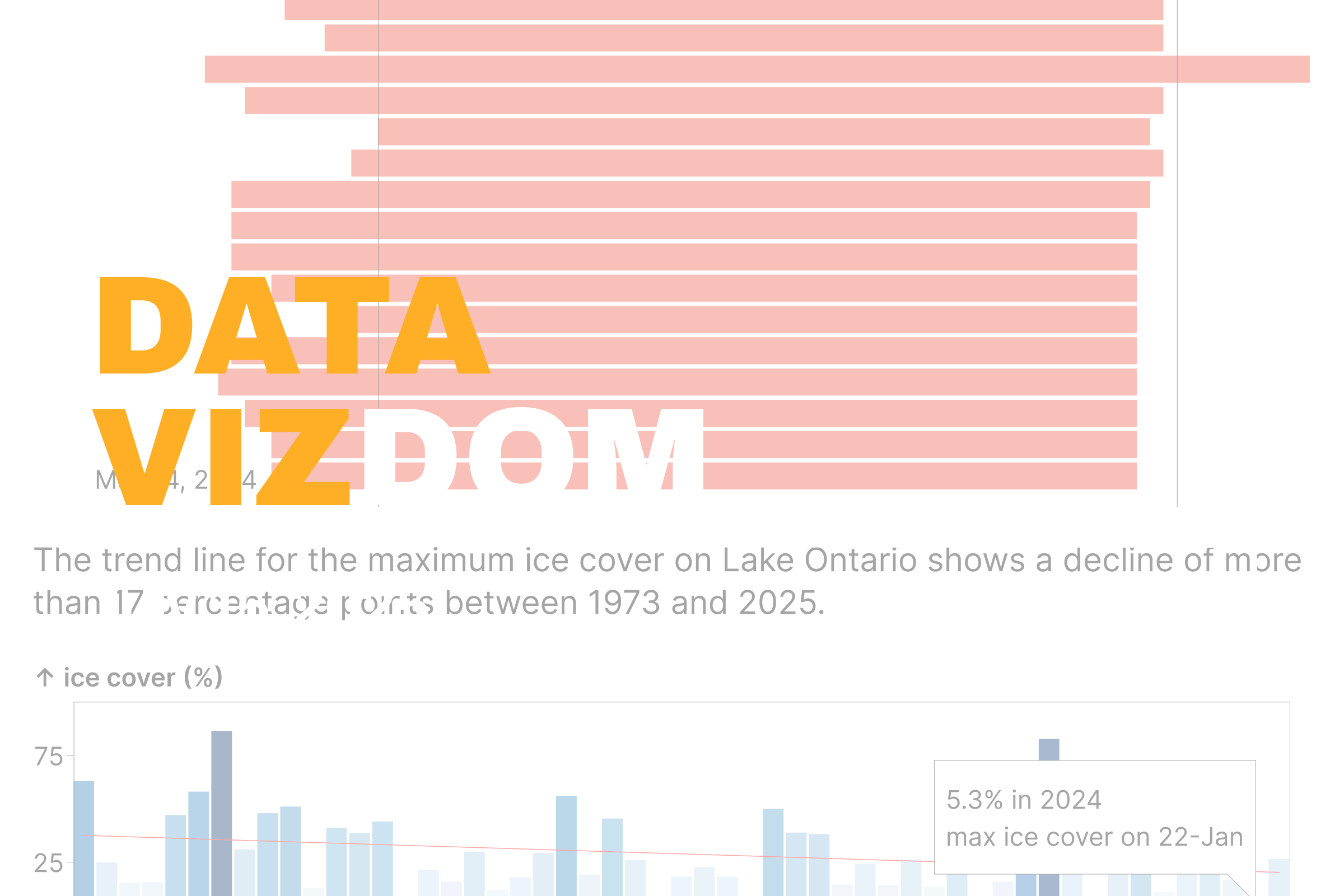
The first part of the interactive chart below shows the opening and closing dates of the Montreal–Lake Ontario section since 2004, with the length of each bar representing the navigation season in days. The second part of the chart shows the annual maximum ice cover on Lake Ontario since 1973.
These shifts in opening and closing dates are not just random fluctuations. They point to a longer, more consistent shipping season. Since 2004, the season has gained about 6.5 days on average. That might not seem like much in a single year, but over time it adds up. It can improve supply chain flexibility, reduce bottlenecks during peak periods, and potentially shift modal decisions for certain types of cargo.
The decline in maximum ice cover on Lake Ontario supports this trend. High-ice years are becoming rare, and the overall pattern shows a clear decline of more than 17 percentage points since 1973. With less ice to deal with, ships can move more freely and the risk of early closures or late starts is shrinking.
Warmer winters are changing the rhythm of trade in this corridor, and the data shows that shift is already underway.
Data Vizdom digs into ideas big and small through visualizations that help make sense of a changing world, drawing on data from the SLGL dataHub.