
What better way to understand concepts big and small than through data visualizations? In this blog series, we bring you a collection of visuals on events, academic theories, and insights around economics and transportation, especially — but not exclusively — from academia and news organizations. Join us to explore and engage with interesting and insightful data visualizations from creators around the world.
The fourth edition of Data Vizdom explores the flip side of climate change on maritime trade routes: the creation of new shipping routes through areas that were once unnavigable because of ice.
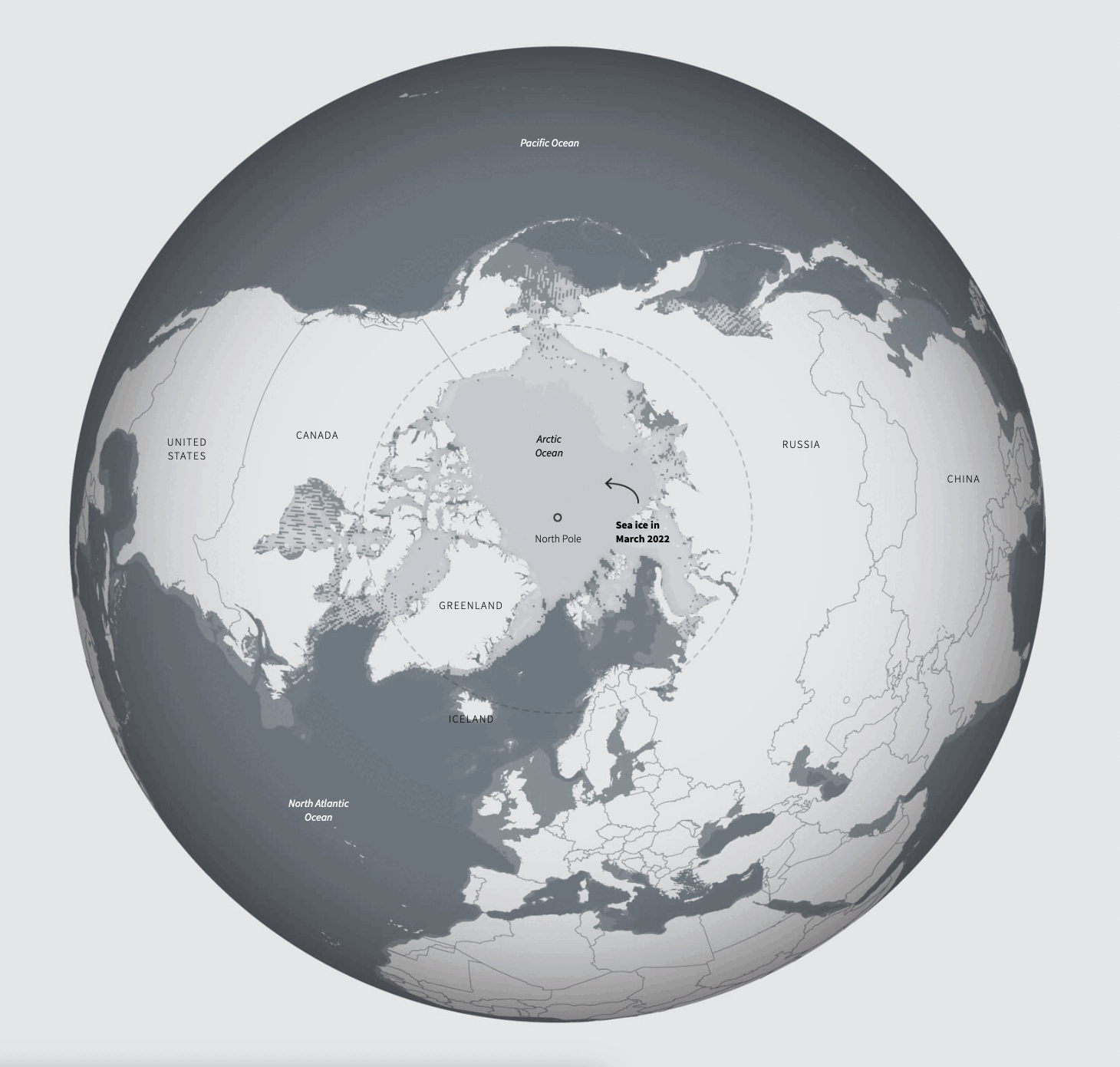
The Arctic’s ice cover has been slowly declining, but over the past few years, this recession has accelerated. The coverage of multi-year ice, which is more resistant to melting, has decreased, being replaced by younger ice that melts during the summer months.
Animation shows severity of Arctic sea ice recession in 2020 – The Washington Post (September 22, 2020)
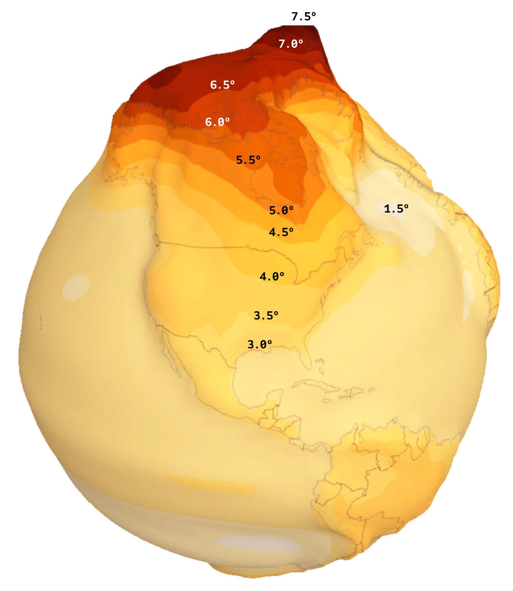
The warming of the Earth is expected to be uneven, with projected temperatures between 2040 and 2060 being disproportionately large in the Arctic. Viewing this rise in temperature as an elevation map helps to understand how it will further negatively impact the ice coverage in the Arctic Ocean over the coming decades.
Arctic – Woodwell Climate Research (n.d.)
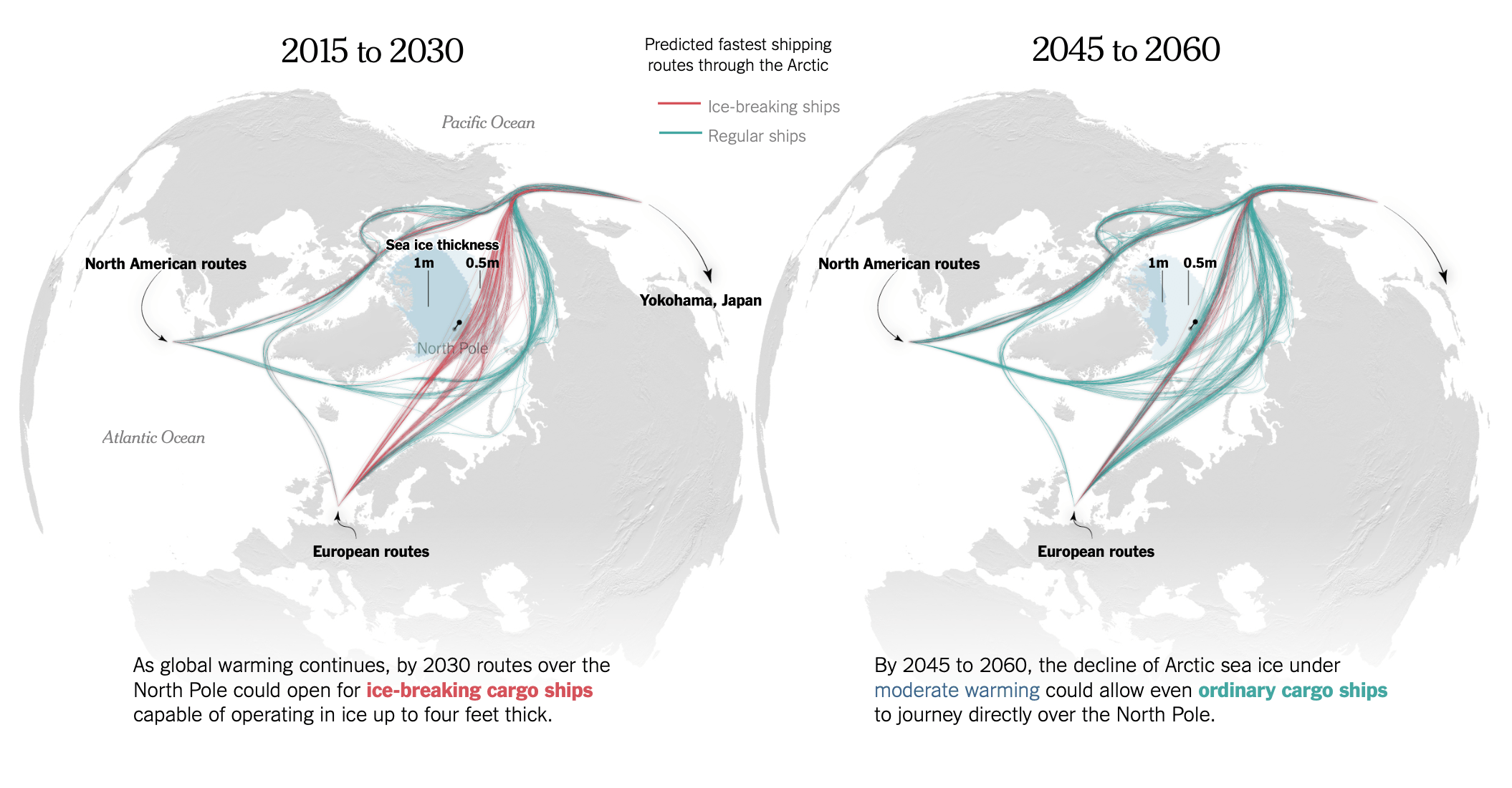
This means that the Arctic, once unimaginable for conventional ships such as those carrying oil and containers to sail through, would become accessible during the summer months. During the colder months, with thinner ice formation, ice-breaking ships (aka icebreakers) could carve out routes for other vessels.
Russia already uses the Northern Sea Route, deploying icebreakers to keep it navigable for ships traveling between Europe and Asia. The Northwest Passage, running along Canada’s coast, is currently less frequently used.
Dark Arctic – Reuters (November 16, 2022)
With ever-decreasing ice formation, it is only a matter of time before the Northwest Passage sees more traffic, as it cuts the distance for ships currently plying through the Panama Canal. Similarly, the Northern Sea Route significantly reduces the distance compared to the Suez Canal. According to current predictions, icebreakers are expected to sail straight through the North Pole, with conventional ships being able to do so in the coming decades. When this happens, the Bering Strait will become a major chokepoint for trade.
As Arctic Ice Vanishes, New Shipping Routes Open – The New York Times (May 3, 2017)
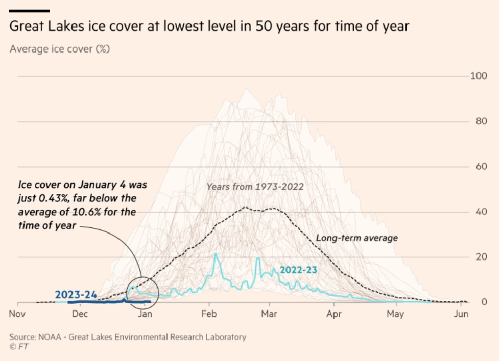
Closer to home, the Great Lakes experienced their lowest levels of ice in over 50 years this past winter. Although extremely alarming, if this trend continues, the lakes may become navigable for ships year-round, making maritime shipping more attractive for businesses in the region.
Ice cover in North America’s Great Lakes hits lowest level for 50 years – Financial Times (January 5, 2024)
Help us make this series even better! We would love to hear about sources we should follow to discover interesting projects and visualizations. Write to Bilal Siddika on LinkedIn or via email.